Di Giovanni Gullà, Gianfranco Nicodemo, Settimio Ferlisi, Luigi Borrelli e Dario Peduto.
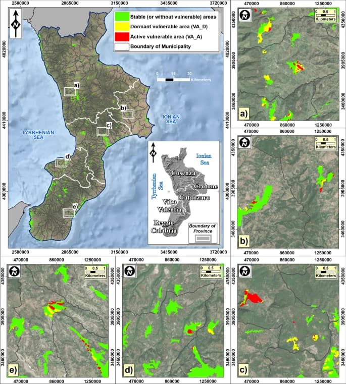
This paper proposes a three-phase method that combines multi-source (i.e. topographic, thematic, monitoring) input data in a GIS environment to rank—at small (1:250,000) scale—administrative units (e.g. municipalities) based on their exposure to slow-moving landslide risk within a selected area (e.g. a region) and, accordingly, detect those primarily requiring mitigation measures. The method is applied in the Calabria region (southern Italy) where several municipali-ties are widely affected by slow-moving landslides that systematically cause damage to buildings and infrastructure networks resulting in significant economic losses. The results obtained are validated based on the information gath-ered from previous studies carried out at large (municipal) scale. The work undertaken represents a first, fundamental step of a wider circular approach that can profitably facilitate the decision makers in addressing the issue of the slow-moving landslide risk mitigation in a sustainable way.